Light Detection and Ranging technology (LiDAR) delivers critical data to protect the health of our ecosystems, and government officials use it extensively.
This particular type of technology is not well known to everyone, but the benefits it provides make it worthy of note. Simply put, LIDAR provides a unique way to check for natural hazards and risks that could potentially threaten our lives and livelihoods. It captures data related to water, energy, minerals and other natural resources essential to life, and it allows public officials to prioritize efforts that protect all citizens. It is used extensively to monitor sustainability and to identify risks.
It uses lasers to measure distances and to create three-dimensional digital mapping data for both commercial firms and public entities. One common application involves collecting LiDAR data for mapping elevations. In these cases, an aircraft will fly over a specific area and pulsate a laser beam downward. The light reflects off the surface below, and a distance calculation is made based on the time it takes to return upward.
LiDAR technology is a key player in ensuring traffic enforcement and safety. By capturing transportation data through equipment mounted beside roadways or on handheld devices, it aids in planning and launching projects that prevent collisions between buses, pedestrians and cyclists, thereby ensuring public safety.
The United States Geologic Survey (USGS), part of the Department of the Interior, provides funding for LiDAR projects at the state and local levels of government. A recent funding allocation will support 14 projects in 13 states. These upcoming projects will be designed to scan more than 99,000 square miles of terrain. The data gathered will be used for planning related to flood risks, forest management, transportation projects, geologic investigations, natural resource conservation and precision farming.

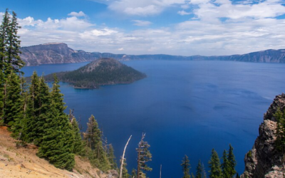
Photo courtesy of the U.S. Geological Survey
Another recent LiDAR project, completed for the state of Tennessee, consisted of 12 projects to capture three-dimensional high-quality topographic data. Considering technology in a simple manner provides essential data about the world’s ecosystem, similar to how an MRI provides important data about people, even though they are different types of technology. LiDAR data enables officials to evaluate potential hazards and make informed decisions for future planning.
A $1.8 million LiDAR project is underway in northwest Arizona. The Hualapai Tribe will use the technology to map vegetation and the landscape to plan for land management projects designed to prevent wildfires. Officials in Blaine County, Idaho, recently completed a project using Greed LiDAR to map underwater topography and the maps will assist in floodplain management and emergency planning.
An upcoming project to be launched by the University of Minnesota College of Science and Engineering will use a LiDAR application to prevent flying wildlife from crashing into wind turbines. This $525,000 project will call for installing LiDAR sensors on wind turbines to provide real-time tracking of flight patterns. Then, changes can be made to reduce the risk of fatal collisions with wildlife. Nearly 1.7 million types of flying wildlife, including endangered species, die from impact with wind turbines in America each year. A long-range LiDAR system combined with bioacoustics sensors will be used. The project’s first phase has a cost estimate of $195,000 and will procure three long-range LiDAR systems with special accuracy of less than 2 centimeters including calibration, customization and testing. The project will continue in four more phases: field testing, LiDAR sensor integration, more field testing, patent filing and information dissemination.
The Arkansas Department of Transformation and Shared Services and the Arkansas GIS Office are collaborating on an upcoming multi-million-dollar LiDAR project. The initiative targets 40 counties as part of Arkansas’ statewide initiative to update geographic and elevation data. This effort will require advanced LiDAR technology to capture high-resolution, Quality Level 1 (QL1) elevation data over 28,060 square miles. The state recently completed the Eastern Arkansas LiDAR project. Solicitation documents are expected soon. The data from this project will enhance the National Map, which is used for infrastructure planning, environmental conservation and national safety at the federal level and across state lines.
The city of Keene in New Hampshire has budgeted for a $150,000 project in fiscal year 2025 to update the city’s digital map. Aerial photography and LiDAR will advance the development of the city’s “digital twin,” or 3D model. The data captured will update a base map from 2015. City officials will consider adding additional LiDAR and map data for other areas managed by the municipality, including Babbidge Reservoir and Preserve, the airport and the wastewater treatment plant. Almost all municipal functions will benefit from the mapping program.
Officials at the Nashville Department of Transportation recently installed the first of seven LiDAR devices as a traffic monitoring initiative in Nashville. The devices will be installed along a roadway with diverse transportation methods, including bike lanes and pedestrian crossings. The information and mapping provided by LiDAR will collect data from near-miss accidents that would otherwise go unreported to inform the city’s Vision Zero plan to reduce traffic injuries and deaths. A federal $2 million grant funds the first phase of this project but the project will potentially benefit from another $20 million.
The City of Fort Lauderdale Police Department has released a request for proposals (RFP) to provide automatic camera equipment to regulate vehicle speed in a school zone. The cameras must have both LiDAR and radar capabilities. It also specifies that proposed systems must have ALPR (Automated License Plate Reader) functions that can integrate with the existing system. The RFP was issued July 20 and the proposals are due Aug. 23.