The 4.2 million miles of roads and highways in the U.S. are critical components of the country’s economic vitality. The transportation infrastructure allows Americans to commute, connect and transport goods efficiently. Yet, many of the older roadways limit access between communities, negatively impacting citizens and businesses. Congress has appropriated an abundance of funding to remedy these situations by supporting projects that reconnect communities with various types of new access options.
The impact has been profound, and many city officials are focused on removing physical and social barriers created by past highway construction. Most projects provide access extensions for pedestrians and cyclists, and often there are project components that include the addition of green spaces, paths and trails that beautify and connect communities.
The projects described below seek to align infrastructure investments with a commitment to social equity, environmental justice and inclusivity.
A large multimodal project with a projected cost of $1.3 billion will be launched in Massachusetts. It is currently in the environmental permitting process, but this large effort will require many types of collaborative engagements between public and private sector partners. The I-90 Allston Multimodal Project will be led by the Massachusetts Department of Transportation and the City of Boston. When completed, it will deliver a reconstructed section of roadway that has been a physical and social barrier in Boston’s Allston neighborhood for many years.
The project will be designed to reconnect neighborhoods previously separated by the interstate and reconfigure the interchange and railyard areas with modernization standards outlined in Complete Streets programming. The existing I-90 interchange no longer meets current interstate highway design standards, so the project will include removing 2,900 feet of elevated highway, constructing a multimodal transit station and adding walking and biking infrastructure. It will also include adding more than 10 miles of new sidewalks and bike trails and reclaiming over 40 acres of land for parks, open spaces and community developments. No timelines have been announced regarding contracting solicitations.

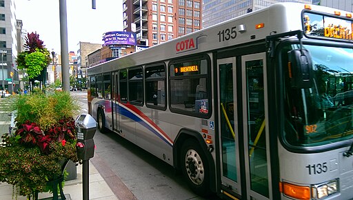
Photo courtesy of Gillig Bus Images.
A project in Denver, Colorado will enhance a roadway and reconnect the Globeville and Elyria-Swansea neighborhoods, which are some of the Mile High City’s most underserved communities. The neighborhoods are located on the east and west banks of the South Platte River and are split by Interstates 25 and 70 as well as multiple railroad lines. This $68 million effort will call for the elimination of natural and man-made barriers by adding bike and pedestrian access. It will also include remediating a large, previously unusable brownfield site so that it can be used for greenspace.
Some aspects of the project are already under construction, including rehabilitation of the Franklin Street Bridge and the construction of a greenway corridor along the river. Other project components, however, are still being designed. Plans call for adding a 10-foot multi-use path and buffered bicycle lanes on the north and south sides of the road, plus a sidewalk on the south side. Another aspect of the overall initiative will provide pedestrian enhancements on Lincoln Street under Interstate 70 including lighting upgrades, sidewalk/pedestrian curb ramp improvements, installation of bulb-outs (concrete curb extensions) and green infrastructure enhancements.
A $61.5 million connecting communities project will provide safe access for pedestrians and cyclists to cross Interstate 10 in New Orleans. A feasibility study found that 6% of the city’s fatal crashes involving pedestrians occurred on the I-10 service roads in New Orleans East. Collectively, the improvements will introduce a network of connectivity for walking, bicycling and transit that will remedy a major mobility gap.
A key feature of the project is a 10-foot shared-use trail that will run along the north and south service roads for the length of the corridor. The design includes ADA-compliant ramps, crosswalks at intersections and the addition of pedestrian signals. Enhanced lighting, trees and landscaping along the trail are also included in the project. To overcome the divide created by I-10, the project will call for three bridges for non-motorized vehicles as well as shared-use trails. Construction is slated for 2025.
The Central Ohio Transit Authority is developing a bus rapid transit system that will connect downtown Columbus with the Prairie Township neighborhood. This connection will also provide access to West Broad Street, a corridor that connects various neighborhoods, hospitals, schools, shopping centers, theaters and museums.
The 9.3-mile project carries an estimated cost of $339 million. It will incorporate rapid bus lanes with dedicated center and curbside lanes, along with construction of 17 new stations. Planned features include near-level boarding at stations, complete streets improvements and enhanced station amenities designed to improve safety and accessibility. It will also include a new park-and-ride facility and on-route vehicle charging at the western terminus. The purchase of 10 zero-emission or electric vehicles will be required, and work is slated to begin in 2025.
Reconnecting Knoxville is an infrastructure initiative designed to restore access between economic and cultural areas in Knoxville that were separated by urban renewal projects, including the construction of James White Parkway. A project with a cost estimation of $85.6 million will connect East Knoxville, Morningside Park, downtown Knoxville and South Knoxville via enhanced transportation pathways and new urban greenspaces.
Currently, the James White Parkway and South Knoxville bridge over the Tennessee River both lack sidewalks and bike lanes. The plan will call for construction of access points for pedestrian and bicycle paths designed to reconnect East and South Knoxville with downtown, local jobs and community resources.
Plans also call for a greenway that will begin at the Old City and end at the Knoxville Botanical Garden and Arboretum. The project includes a Cultural Corridor – a multi-modal pathway that features markers, maps and digital resources highlighting the African American history that once thrived alongside or near the corridor. The project is currently in the final design phase, and work is expected to begin in 2025
Officials in Milwaukee are planning to revitalize a 2.6-mile stretch of Sixth Street to provide community access to several historically marginalized neighborhoods. Originally separated by the construction of Interstate 94/I-43 in the 1960s, several communities have experienced extensive disruption and isolation. This $36.5 million project will be designed to create a unified, accessible route through these diverse areas.
The transformed street will feature dedicated lanes for walking, biking and public transit, emphasizing safer, multimodal access across the corridor. Plans include new public transit lanes with enhanced stations where feasible, fully separate bicycle lanes and a narrower roadway to reduce vehicular travel lanes. Trees and green space will be incorporated along the route to enhance the urban landscape and relieve the burden on Milwaukee’s combined sewer system. Design for the project will begin in 2025, but construction may be delayed until 2029.
These upcoming projects will provide various types of contracting opportunities and the work, when completed, will revitalize the economy of numerous regions.


